0 BIRCH DRIVE, HYANNIS
Owner Information
QUINLAN, RAYMOND L & MORGAN, JANE B
PO BOX 536
WEST HYANNISPORT, MA 02672


Property Details
0 BIRCH DRIVE, HYANNIS is classified as a Undevelopable Residential Land (Vacant land).
0 BIRCH DRIVE, HYANNIS is valued at $3,300. The land is valued at $3,300 and the structures are valued at $0.
This property is in Zone RB. Confirm with local Zoning Board authorities to ensure there are no overlays or other easements on this property.
The most recent deed for 0 BIRCH DRIVE, HYANNIS is recorded at the local registrar in Book 12452, Page 0209. 0 BIRCH DRIVE, HYANNIS was last sold on Tuesday, August 3, 1999 for $500,000.
Assessment data from fiscal year 2022.
Flood Data
This property has multiple flood prone designations.
| Zone | Description | BFE | Area |
|---|---|---|---|
| AE | within floodplain | 13 | 0.1 (5.25%) |
| VE | coastal flooding with wave action | 14 | 1.64 (94.75%) |
This information is sourced from the FEMA National Flood Hazard Layer. See our full disclamer.
Broadband Internet Providers
| Provider | Type | Bandwidth (mbps) | |
|---|---|---|---|
| HughesNet | Satellite | 25 | 3 |
| Comcast | Cable | 1000 | 35 |
| Verizon New England Inc. | DSL | 7 | 0 |
| Viasat Inc | Satellite | 35 | 3 |
| VSAT Systems, LLC. | Satellite | 2 | 1 |
| GCI Communication Corp. | Satellite | 0 | 0 |
Broadband service provider data from December 2020.
Adjacent Properties
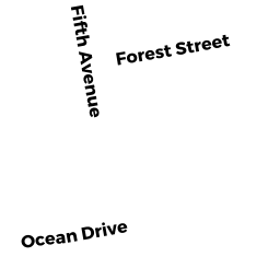
- 0 OCEAN DRIVE, HYANNIS
Vacant, Selectmen or City Council (Municipal) owned by BARNSTABLE, TOWN OF (MUN) - 75 OCEAN DRIVE, HYANNIS
Undevelopable Residential Land owned by MCDONALD, JOSEPH D & MADELEINE - 190 FIFTH AVENUE (HYANNIS), HYANNIS
Undevelopable Residential Land owned by MCDONALD, JOSEPH D & MADELEINE - 40 BIRCH DRIVE, HYANNIS
Single Family Residential owned by VOGT, ARTHUR O & SUSAN L N